

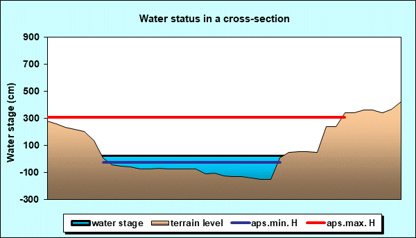
Reporting surface water station: MATARUŠKA BANJA
Choose name of station for more information.| Station: | MATARUŠKA BANJA | ||
|---|---|---|---|
| River: | IBAR | ||
| Basin: | ZAPADNA MORAVA | ||
| Foundation year: | 2020 | ||
| KOTA "0" (m n.J.m.): | 206.32 | ||
| Distance from the river mouth (km): | 16.330 | ||
| Basin area (km2): | 7862.00 | ||
| Date: SATURDAY, 16.05.2026. | |||
| Water stage (cm) |
Change of water stage (cm) |
River flow (m3/s) |
Water temperature (оC) |
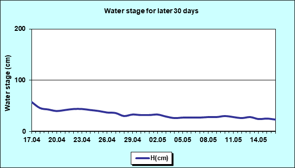
| 56.8 |
|||
| Tendency | Ice events | First flood alert (cm) |
Second flood alert (cm) |
 |
- | - | - |
Diagrams


|
|
|
 Page print Page print |
| © 2026 Copyright RHMS of Serbia |